Help reduce the risk of fire this summer
The fire danger rating is high at Burnaby parks, beaches, trails and outdoor spaces. The use of CSA-approved propane/gas barbecues and cooking stoves is allowed. You must stay with the barbecue or stove at all times while using it.
Learn more about restricted activities at Burnaby.ca/FireSafety
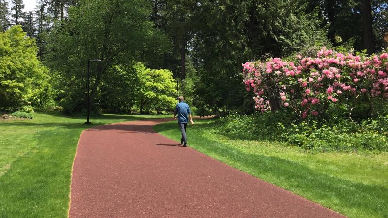
Get some fresh air while exploring the outdoors
Walk along the peaceful shore path at Barnet Marine Park, hike the rugged trails of Burnaby Mountain or bike the Central Valley Greenway from Vancouver, through Burnaby to New Westminster.
About our trails and urban pathways
Our trails and pathways range from those with paved and maintained gravel surfaces in urban areas to rocky and root-filled paths in natural environments. Many of our trails have learning objectives so be sure to look for posted information and learn about the natural environment and park history surrounding you.
We also rate our walking, hiking and biking trails by their level of difficulty on maps and signage.
- Easy–relatively flat with only gentle inclines and maintained trail surfaces.
- Medium–mostly flat but with some hills up to a 10% incline. These trails are more likely to be gravel or dirt.
- Difficult–some lengthy steep sections, with narrower, rugged paths. We recommend you wear sturdy footwear if you're walking and proper gear if you're biking. These trails are set in natural environments mostly in the Burnaby Mountain area, so be prepared for weather changes whether on bike or on foot.
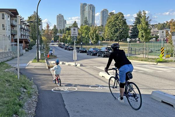
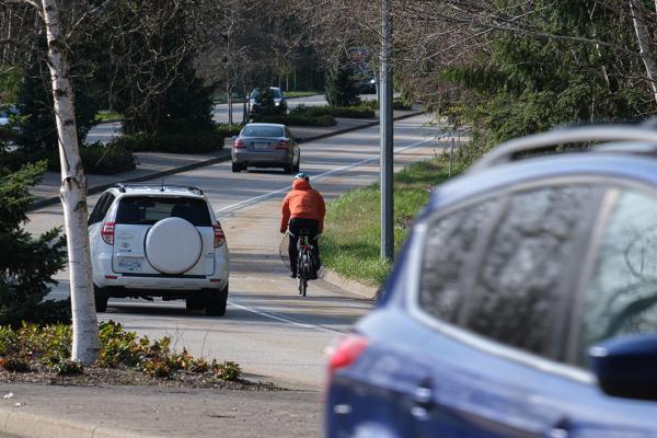
Explore our routes
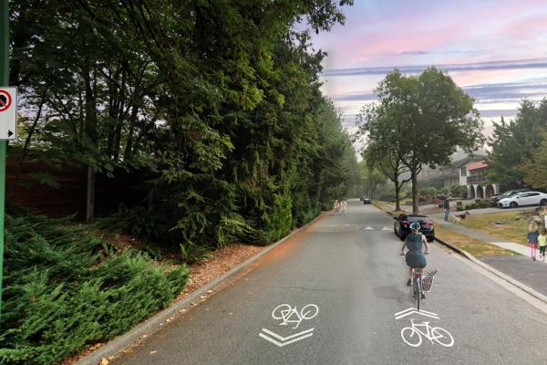
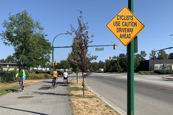
Burnaby has more than 70 km of bike routes and urban trails and pathways that connect Burnaby from north to south, east to west and to our neighbouring cities. Take a greener commute or walk your way to a healthy and active lifestyle.
Best of all, many of our parks are close to SkyTrain stations and bus stops, making it easy for you to walk or cycle to your trail or pathway.
Burnaby Mountain Conservation Area Trails
Take an exhilarating daytime hike up Burnaby Mountain or visit at dusk to see a dramatic sunset over the mountains, the inlet and our city.
Central Valley Greenway
The Central Valley Greenway runs from Vancouver through Burnaby to New Westminster—giving you the chance to enjoy Metro Vancouver’s beautiful urban and natural spaces by bike or foot.
BC Parkway and Highland Park Line
Take a stroll or ride along Metro Vancouver’s original recreational bike and pedestrian route. You can venture all the way from the Westminster Quay riverfront across Burnaby to False Creek in Vancouver.
Rumble Street Urban Trail
Stay active on this multi-use urban trail, connecting McKay Ave and Royal Oak Ave in southwest Burnaby.
Willingdon Linear Park
Walk, ride or run along this scenic urban trail and enjoy engaging public art along the way. This 13 block linear parkway runs along Willingdon Ave between Brentwood Town Centre and Hastings St.
Central Park Perimeter Trail
The Central Park Perimeter Trail is one of the longest continuous rubberized tracks for walking and running in Metro Vancouver.
Trans Canada Trail
The Burnaby portion of the Trans Canada Trail (TCT) is a 12.1-kilometre route incorporating a number of trails crossing the city along its northern fringe–from Barnet Highway in the east to Montrose Park near Boundary Road in the west.
Visit our neighbours
Check out bike and walking route information for our neighbouring cities in Greater Vancouver.
-
 Completed
Edmonds Town Centre Cycling Network
As part of the City’s Priority Cycling Network that is envisioned in Burnaby’s Transportation Plan, Connecting Burnaby, the City is looking to improve the current cycling network in the Edmonds Town Centre area. -
 In progress
Vancouver to SFU Cycling Connection
We’re improving the Frances-Union Bikeway and Burnaby Mountain Parkway to better connect these routes to key areas, including Simon Fraser University (SFU), the Union-Adanac Bikeway in Vancouver and other local and regional destinations. -
 In progress
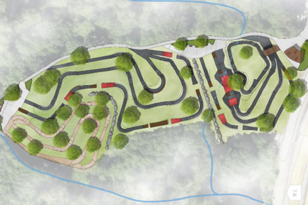
Mountain Air Bike Skills Course Redevelopment
The City of Burnaby is redeveloping the Mountain Air Bike Skills Course to build upon the current popularity of the course and raise it to a first-class local destination for biking enthusiasts. -
 Planned
Lakefield Drive Active Transportation Improvement Project
The City is seeking public input on plans to implement a series of active transportation improvements along Lakefield Drive and 4th Street between Nursery Street and Wedgewood Street. -
 In progress
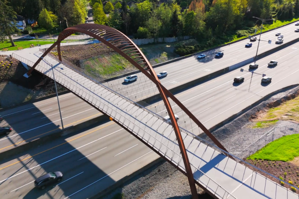
Burnaby Lake Overpass
The City is building a pedestrian-cyclist overpass across Highway 1 to create a critical north-south link between key regional trail networks and destinations within Burnaby. -
 Completed
Still Creek Avenue Active Transportation Improvements
The purpose of this project is to upgrade the active transportation facilities on Still Creek Avenue between Douglas Road to the east and the Burnaby Eco-Centre to the west to improve the safety and experience for pedestrians and cyclists. -
 Completed
Sperling-Duthie Traffic, Pedestrian & Cycling Safety Study
We’re conducting a study of the Sperling Avenue and Duthie Avenue corridors to develop strategies and solutions to enhance the safety of everyone using these routes. -
 In progress
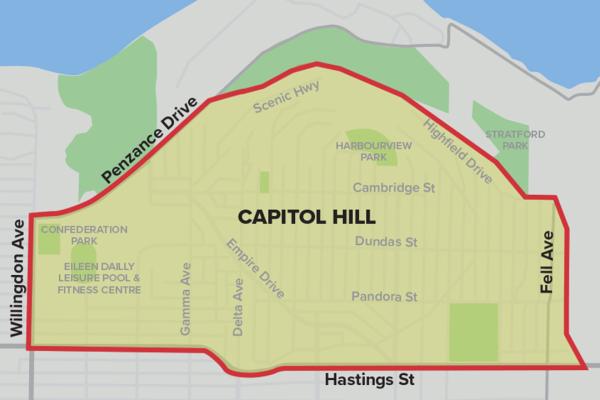
North Burnaby Traffic Calming Study
We’ve completed a comprehensive study of the Burnaby Heights/Capitol Hill neighbourhood to identify opportunities to improve travel safety for pedestrians, cyclists and drivers. -
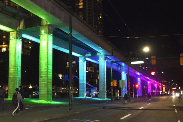 In progress
BC Parkway Illumination
We’re adding accent lighting to the Burnaby section of BC Parkway to make the route more lively and inviting for everyone, whether you walk or roll, at any time of day. -
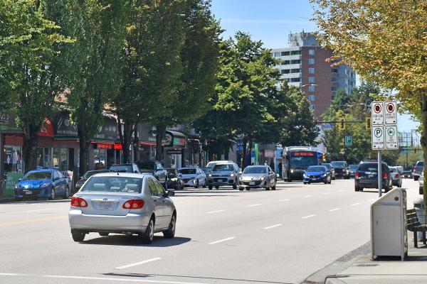 Completed
Hastings Street Improvement
TransLink and the City of Burnaby are partnering to study street improvements on Hastings Street between Boundary Road and Duthie Avenue.